
Tropical Wave Off Africa Being Monitored for Development
A tropical wave coming off Africa is being monitored for development, but so far, it only has a low chance of succeeding. The National Hurricane Center is keeping a close eye on the disturbance, which is forecast to move off the African coast soon.
As we head into the Labor Day weekend, the tropics are relatively calm, unlike many Labor Day weekends in the past. The most infamous landfalling hurricane in the record books, the Labor Day Hurricane of 1935, destroyed the area around Islamorada in the middle and upper Florida Keys. This hurricane had the strongest estimated winds at landfall of 185 mph and the lowest pressure ever recorded on land in the world.
Current Weather Conditions and Forecast
The current weather conditions are favorable for a quiet weekend, but the disturbance off the African coast is worth monitoring. The National Hurricane Center is giving it a low chance of developing over the next week as it tracks across the tropical belt. Some computer forecast models suggest it could become a tropical depression or low-end tropical storm for a few days before encountering hostile upper-level winds closer to the Caribbean islands. 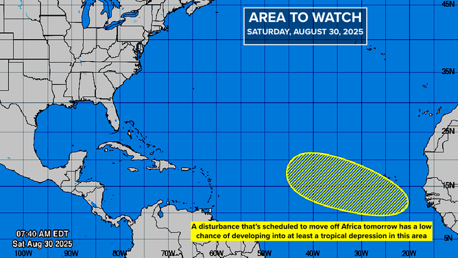
Long-range forecast models show the system as a viable storm north of the islands, but this is nearly two weeks from now and should be taken with caution. These long-range forecasts can be unreliable and tend to change frequently. The system is forecast to move slowly across the tropical Atlantic, taking more than a week to reach the vicinity of the islands.
Outlook for the Rest of the Month
There are indications that the Atlantic will become more conducive to tropical development in the second week of September or the middle of the month. This is a logical expectation, but only time will tell. For now, it’s a good idea to enjoy the Labor Day weekend, which is hurricane and tropical storm-free. For the latest updates and forecasts, visit Here
Image Source: www.foxweather.com
