
Hurricane Season Update: Tropical Disturbance Off Africa and Pacific Storms
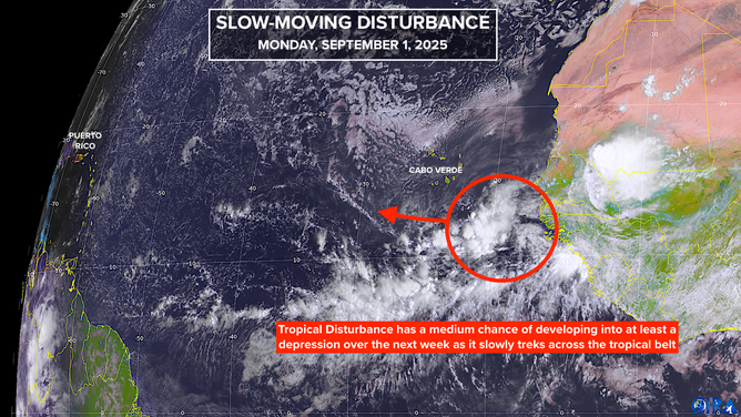
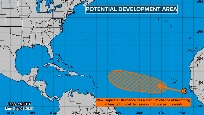
The National Hurricane Center has increased the odds of development of a disorganized tropical disturbance off the coast of Africa to the medium range. According to the latest forecast, the steering currents are weak across the tropical belt, which means it will take at least a week for the system to reach the general vicinity of the Caribbean islands. The atmospheric conditions are only moderately conducive for development between the Caribbean and Africa, but it doesn’t take much for a tropical depression to spin up.
The long-range forecast is less certain, with various computer models diverging in their predictions. Some show a weak disturbance continuing west, while others predict the system will evolve into Tropical Storm or Hurricane Gabrielle and turn north. However, there is a consensus that a strong dip in the jet stream will be reinforced over the eastern U.S., which should continue to deflect any strong storms to the north.
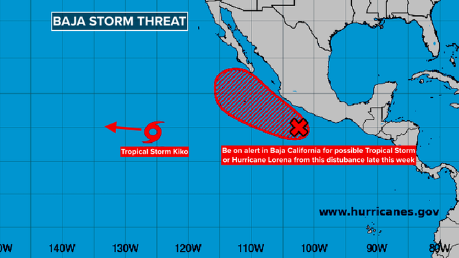
Pacific Storms: Tropical Storm or Hurricane Lorena
A disturbance tracking parallel to the Mexican coast is likely to develop into Tropical Storm or Hurricane Lorena before it reaches the Baja California Peninsula of Mexico. Computer forecasts indicate that the system has a decent chance of reaching hurricane strength. On the current schedule, the system will be in the vicinity of Cabo San Lucas on the southern tip of Baja on Wednesday, and residents and visitors should stay well-informed.
The Atlantic tropics are still mostly in shutdown mode, but it’s essential to keep a close eye on the developments in the Pacific. For the latest updates and forecasts, visit Here
Image Source: www.foxweather.com
