
Tropical Storm Mario Forms Off the Coast of Mexico, Bringing Heavy Rainfall and Dangerous Surf
The National Hurricane Center is closely monitoring a tropical depression that formed off the southern coast of Mexico on Thursday, which is expected to become the thirteenth named storm of the eastern Pacific hurricane season. As of Thursday, the cyclone was centered about 100 miles off the coast of Acapulco, producing maximum sustained winds near tropical storm strength.
The agency said gradual strengthening is possible, and the system is expected to be named Mario once winds reach at least 39 mph. No tropical storm watches or warnings have been issued, but officials urged residents of southwestern Mexico to monitor the progress of the system as it tracks roughly parallel to the coastline. Even without a direct landfall, heavy rainfall and dangerous surf are possible along portions of the southern coast over the next several days.
Forecast and Potential Impacts
Forecast models showed rainfall totals of 2 to 4 inches through the weekend, with mountainous areas potentially seeing precipitation amounts of up to 6 inches, which can cause flooding and mudslides. Satellite imagery showed the system only becoming slightly better organized on Thursday, but forecasters expect the cyclone could reach Category 1 hurricane strength by the end of the weekend.  Tracking the tropics
(FOX Weather)
The FOX Forecast Center said a ridge of high pressure over northern Mexico and the southern U.S. is expected to keep the system moving on a west-northwest trajectory, but by next week, the system could begin a more northward motion, which will be important in determining whether it will ever affect the Baja California Peninsula. The timing of that northward turn is critical, as a more westerly track would keep the cyclone well offshore, while a sharper curve could bring hazards closer to the Baja.
Current Hurricane Season
The formation of the cyclone comes just days after Hurricane Lorena passed about 200 miles off the coast of Cabo San Lucas earlier in the month. That system remained offshore but still brought flooding, rough surf, and hazardous conditions to portions of northwestern Mexico. The 2025 eastern Pacific hurricane season began on May 15 and will continue through Nov. 30, with several additional formations likely in the coming weeks. 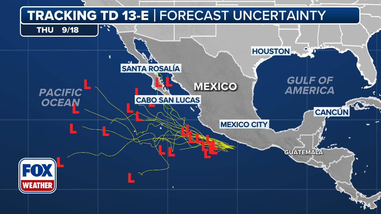 Tracking the tropics
(FOX Weather)
Cooler sea surface temperatures and drier air across the Pacific are also likely to serve as barriers, causing the cyclone to significantly weaken before reaching the coastline. For the latest updates on Tropical Storm Mario, including its track, intensity, and potential impacts, visit the Here for more information. 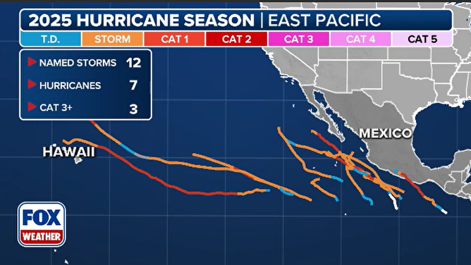
2025 Pacific cyclone tracks
(FOX Weather)
Image Source: www.foxweather.com
