
Tropical Storm Gabrielle Expected to Strengthen into Hurricane
Tropical Storm Gabrielle is forecasted to intensify into the second hurricane of the Atlantic season by Sunday, according to the National Hurricane Center (NHC). The storm is anticipated to pass east of Bermuda on Sunday night, but its exact impact on the island remains uncertain.
The NHC advisory indicates that Gabrielle is currently a tilted storm, with strong upper winds pushing thunderstorms to the east side, hindering its strengthening. However, these hostile conditions are expected to subside, allowing the storm to intensify. The consensus among computer forecast models suggests that Gabrielle will track over warmer waters, creating a conducive environment for strengthening.
Forecast and Potential Impacts
A satellite image of Tropical Storm Gabrielle, taken on September 19, 2025, shows the storm’s current state. 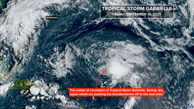 The National Hurricane Center forecast still predicts that Gabrielle will reach hurricane strength as it approaches Bermuda on Sunday. Most computer forecast models indicate that the storm will pass east of Bermuda, although the intrinsic errors in forecasts for poorly developed storms are larger, emphasizing the need for continued monitoring.
Assuming Gabrielle passes east of Bermuda, its impact on the island will depend on the storm’s proximity. Even if it passes at a distance, the storm’s energy could still affect beachgoers and boaters. The National Hurricane Center is also tracking a tropical disturbance off the coast of Africa, which has a low chance of developing into a tropical depression over the next several days.
Long-Range Outlook and Historical Context
In the far eastern Atlantic, the tropical disturbance is expected to move west-northwest, but the dry and hostile atmosphere is unlikely to support significant development. 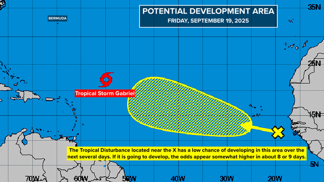 The long-range outlook suggests that the weather pattern over the Atlantic will change, with high pressure potentially blocking disturbances from turning north. This could lead to an environment more conducive to development in the western Caribbean.
Historically, hurricanes often come in clusters, as seen in the 1950s when the East Coast experienced a series of hurricanes, including Hurricane Ione, which made landfall in North Carolina on September 19, 1955. 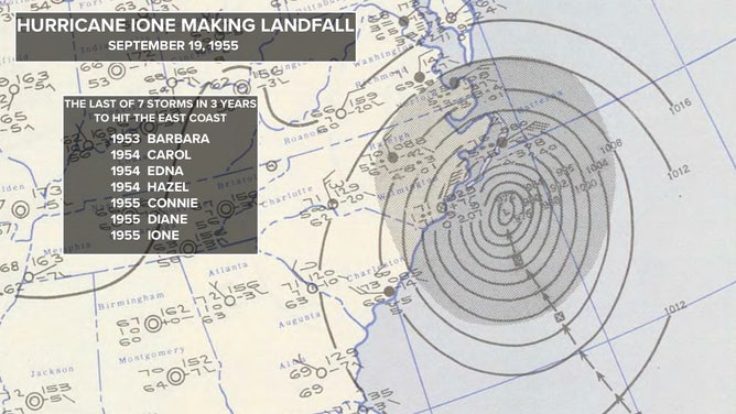 For more information and updates on Tropical Storm Gabrielle and other weather events, visit here.
Image Source: www.foxweather.com
