
Atlantic Tropics: Area to Watch in October 2025
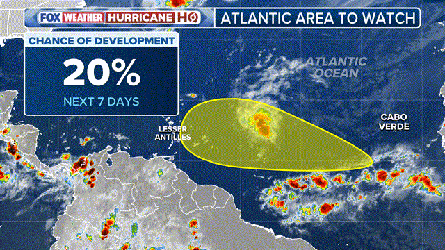
The National Hurricane Center has identified a region in the Atlantic, stretching from the Caribbean islands eastward into the open ocean, as an area to watch for potential tropical cyclone development over the next week. According to FOX Weather Hurricane Specialist Bryan Norcross, former Hurricane Humberto has merged with a dip in the jet stream over the North Atlantic, which could strengthen Hurricane Imelda as it approaches Bermuda.
The energy that is expected to make up the tropical wave is forecast to leave the coast of Africa by Friday and traverse the Atlantic over the next couple of weeks. However, forecasters caution that there are conflicting signals on whether a disturbance in the area will ever become organized. Due to the amount of organization the tropical disturbance will need, quick intensification is not expected over the next week, despite warm sea surface temperatures. The National Hurricane Center (NHC) is currently predicting a low chance of development within the next seven days.
Tropical Wave Tracker
 The FOX Forecast Center says it will likely be toward the end of the second week of October when the wave approaches a “fork in the road,” determining whether it develops into a storm or fades into disorganized showers. Computer models remain split on whether the next named storm on the 2025 list, “Jerry,” will form out of the broad complex of thunderstorms. The Global Forecast System (GFS) continues to show the tropical wave organizing into a cyclone just east of the Caribbean islands, while the European Centre for Medium-Range Weather Forecasts (ECMWF) keeps the system weak and disorganized throughout its lifespan.
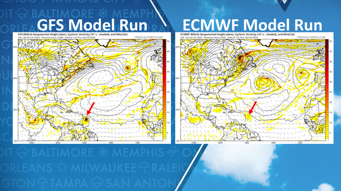 It is common for major forecast models to display wide differences during the infancy of a tropical system. Over the next several days, forecasters expect the models to gradually converge on a more consistent solution. A system that tracks closer to the equator has a greater chance of moving farther west across the Atlantic, compared with a system that forms at 20 degrees latitude or farther north.
Hurricane Season Outlook
During October and November, a plethora of troughs and cold fronts frequently sweep across the Atlantic, which can easily recurve tropical cyclones harmlessly into the open ocean. Systems that remain farther south, however, may pose more of a concern for the Caribbean and other landmasses. The Atlantic hurricane season officially runs through November 30, and on average, October and November yield about four named storms, with two of those typically reaching hurricane strength and one intensifying into a major hurricane. 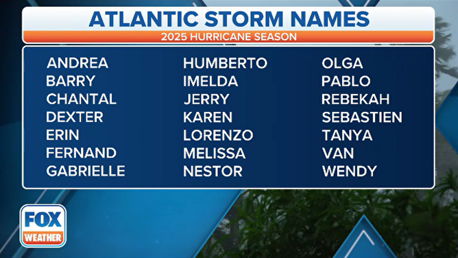
For the latest updates on the Atlantic tropics, visit Here
Image Source: www.foxweather.com
