
Current Hurricane Outlook and Forecast
As of August 26, 2025, Tropical Storm Fernand is moving into the North Atlantic, where it is expected to dissipate within a day or so. The Atlantic is currently quiet, with no other significant tropical systems in the area. However, a disturbance may develop off the coast of Africa around next Saturday, although dry air, hostile upper winds, and strong high pressure across the tropical belt are currently forecast to inhibit significant development.
Around this time last year, the Eastern Pacific was experiencing a busy period of tropical activity, with multiple storms developing in the region. This was followed by a period of increased activity in the Central Pacific, south of Hawaii. The conducive conditions for tropical development then progressed across Central America and into the Caribbean, Gulf, and Atlantic, leading to a busy stretch of hurricane activity in the Atlantic.
FOX Weather is your Hurricane HQ
(FOX Weather)
Understanding the Madden-Julian Oscillation (MJO)
The Madden-Julian Oscillation (MJO) is a broad pulse that tracks around the equator, moving from west to east. It has a supportive phase and a suppressive phase, and can have a significant impact on tropical development. The MJO is currently in a suppressive phase, which is expected to continue for the next couple of weeks. However, a new MJO phase is forecast to develop over the Pacific, which could lead to increased tropical activity in the Atlantic around the second week of September.
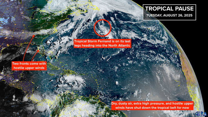
This image shows information on Tropical Storm Fernand and the rest of the tropical Atlantic basin.
(FOX Weather)
Tropical Activity in the Eastern Pacific
The Eastern Pacific is currently experiencing an increase in tropical activity, with a tropical storm and other possible disturbances developing in the region. This activity is not currently linked to the MJO pulse, but could be a sign of things to come in the Atlantic. The Eastern Pacific often experiences increased activity when the Atlantic is quiet, and this can sometimes be a precursor to increased activity in the Gulf and Caribbean.
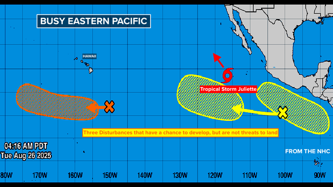
This image shows information on the tropical Pacific Basin.
(FOX Weather)
Watching for Future Development
A sharp cold front is currently pushing south across the eastern United States and will linger over Florida, which could lead to increased chances of tropical development. Additionally, a disturbance may develop off the coast of Africa next weekend, which will be monitored for potential development. While there are currently no significant threats on the horizon, it’s essential to stay informed and up-to-date with the latest forecast and developments.
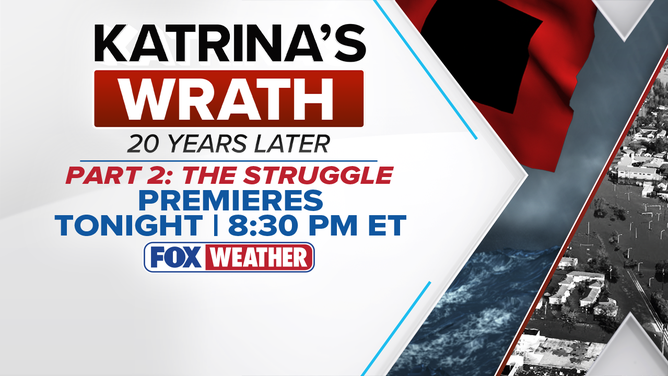
Katrina’s Wrath: 20 Years Later Tuesday night with Part 2: The Struggle. It will be on FOX Weather at 8:30 p.m. ET.
(FOX Weather)
For more information and to stay up-to-date with the latest hurricane forecast and analysis, tune in to FOX Weather at 8:30 p.m. ET for Katrina’s Wrath: 20 Years Later, Part 2: The Struggle. You can also visit Here for the latest updates and information.
Image Source: www.foxweather.com
