
Winter Weather Pattern Continues Across the United States
The active December winter weather pattern, fueled in part by La Niña, is expected to bring another round of fast-moving snowstorms across the Northern Plains, Midwest, and Northeast through next week. The start of meteorological winter, which officially began last Monday, has already seen a cross-country winter storm and systems that have delivered feet of lake-effect snow.
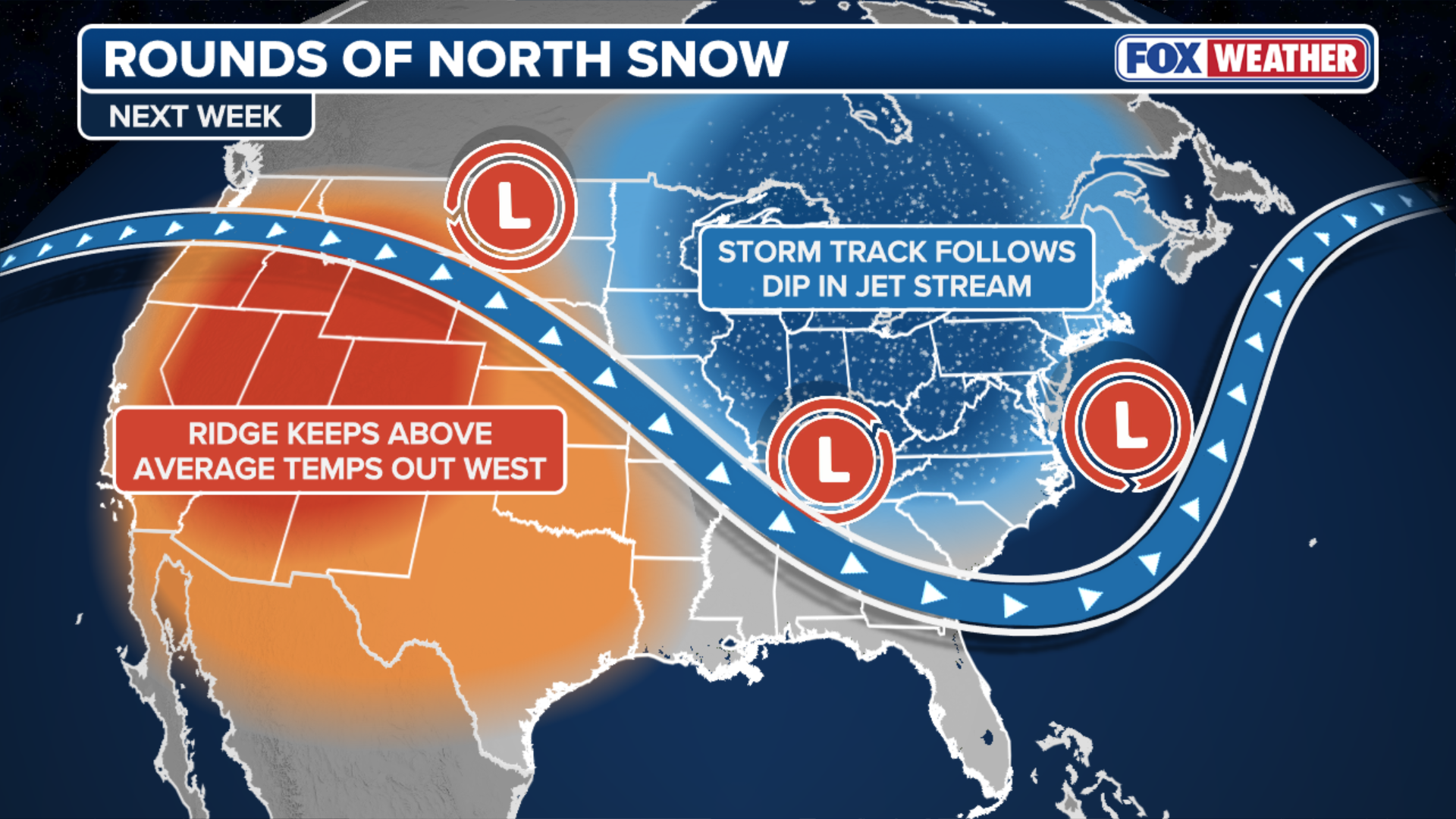
Clipper Systems to Bring Snowy Conditions
An expansive ridge of high pressure over the Pacific Northwest will intensify this weekend and act like a conveyor belt, directing the bulk of incoming Pacific moisture over a large dip in the jet stream. This moisture will tap into arctic air spilling in from Canada to produce several fast-moving snowstorms, known as clippers.

A snowplow drives down a street during a snowstorm in Chicago, Illinois, US, on Saturday, Nov. 29, 2025. Hundreds of flights have been canceled in and around Chicago and roads are becoming treacherous as one of the busiest travel weekends of the year collides with a major storm bringing wintery conditions throughout the US Midwest Saturday. (Getty Images)

Snow covered vehicles parked on a street during a snowstorm in Chicago, Illinois, US, on Saturday, Nov. 29, 2025. Hundreds of flights have been canceled in and around Chicago and roads are becoming treacherous as one of the busiest travel weekends of the year collides with a major storm bringing wintery conditions throughout the US Midwest Saturday. Photographer: Jim Vondruska/Bloomberg via Getty Images (Photographer: Jim Vondruska/Bloomberg via Getty Images)
Expected Snowfall and Affected Areas
According to the FOX Forecast Center, the first clipper will race into the Northern Plains, Midwest, and Ohio Valley on Saturday night. Because of the system’s fast movement, snow totals are projected to remain limited to 1-3 inches. By Tuesday, another clipper is forecast to develop over southern Canada and track into the Upper Midwest.
 Rounds of fast-moving storms to blast Northern Tier with snow and wind.
(FOX Weather)
By midweek, another blast of cold air from Canada is expected to settle across that same area, providing ideal snowmaking conditions for ski resorts. Once this cold air is established, a third clipper system could move through the area on Thursday and Friday, again affecting parts of the Midwest.
 Expected snowfall.
(FOX Weather)
Through next week, cities most likely to see accumulating snow include Minneapolis, Chicago, and Buffalo, New York. Cleveland could see snow every day next week.
Conclusion and Further Information
People in states from North Dakota through Ohio and into Maine should monitor the latest forecast. For more information on the winter weather pattern and expected snowfall, visit Here
Image Source: www.foxweather.com
