
Arctic Blast Brings Subzero Temperatures to Millions of Americans
A winter chill is sweeping the nation, as a blast of arctic air kicks off December, affecting millions of Americans with some of the coldest temperatures of the season.
Arctic air is sweeping the nation just in time for the start of meteorological winter, causing over 235 million Americans to experience below freezing temperatures through the end of the week. Monday is set to be the coldest day of the arctic air outbreak, where temperatures will be subzero across Montana, the Dakotas, Wyoming, Minnesota, and Wisconsin.
Cold Weather Advisories and Record-Breaking Lows
Cold Weather Advisories are in effect for northern Montana since the wind chill will cause it to feel 20 to 30 degrees below zero, while Chicago, Milwaukee, and Des Moines may wake up to single-digit temperatures. Those cities’ temperatures are not expected to climb above zero at any point this week.  The bitterly cold air is also expected to reach as far south as the lower Mississippi River Valley, which may lead to a minor ice event.
According to the FOX Forecast Center, the arctic blast dropped into the Mountain West from Canada due to a dip in the jet stream on Saturday and continued to spread the cold air across the south and east throughout the weekend. On top of the arctic blast, millions of Americans are enduring two powerful winter storms. One record storm over the Thanksgiving holiday weekend slammed the Midwest with up to a foot of snow.
Winter Storms and Arctic Blast
Meanwhile, the other cross-country storm moved out of Canada into the Rockies on Sunday, which will cause even more snow due to the arctic blast temperatures as it charges east. Many areas will continue to experience below freezing temperatures on Tuesday and Wednesday with the coldest air lingering over the High Plains and Upper Midwest. 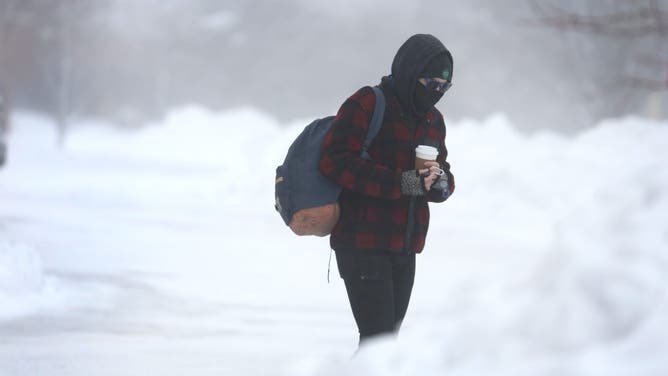 By Thursday and Friday, a cold front will move through the nation, ushering in another surge of arctic air.
This push of freezing air will make conditions even colder, setting the stage for potentially record-breaking lows in the morning. The cold blast will impact the Midwest on Thursday, creating below zero morning temperatures in the Dakotas, Minnesota, Wisconsin, and Iowa. 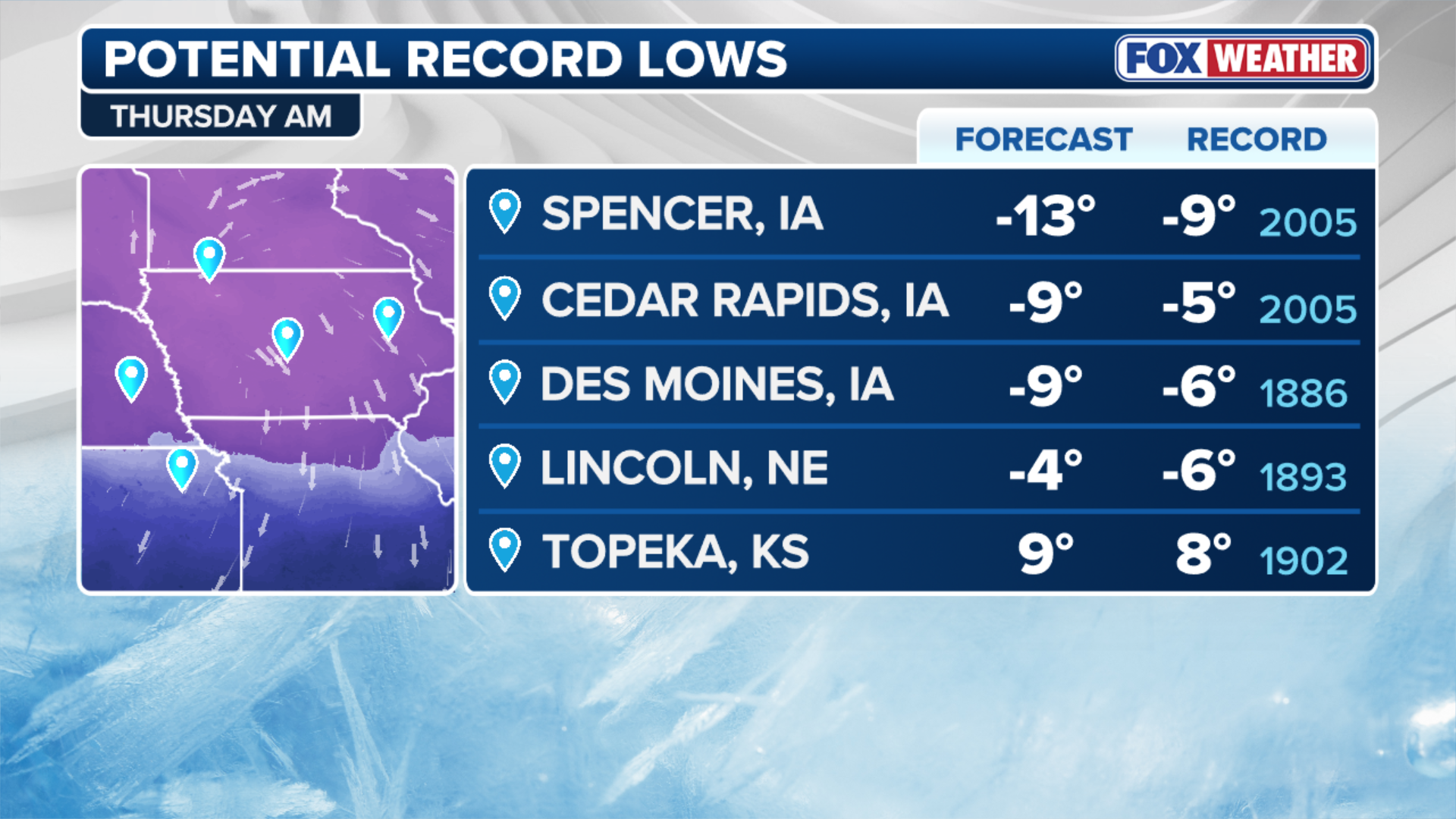 Potential record-breaking low temperatures expected on Thursday. By Friday, the cold will expand from the Midwest all the way to the I-95 corridor, causing record low temperatures in the morning, affecting Pittsburgh, New York, Indianapolis, and Baltimore.
Expert Forecasts and Climate Patterns
Experts say that these temperatures are more typical for early February than December, which validates the forecasts from early November that predicted a cold and snowy start to the winter due to a weakening in the Polar Vortex and the emergence of the La Niña climate pattern. According to NOAA’s Climate Prediction Center, the cold and snow conditions will remain for most of the first half of this month.  For more information, visit Here
Image Source: www.foxweather.com
