
Hurricane Season Update: Tropical Disturbance in the Atlantic
A cluster of sustained thunderstorms has developed in relation to a large tropical disturbance in the eastern Atlantic, as reported by the National Hurricane Center. However, the system is currently very disorganized and surrounded by dry and dusty air, making it unlikely to develop an organized circulation for at least a couple of days.
The system’s development chances are being closely monitored, with the National Hurricane Center setting the odds in the high range that it will develop into at least a tropical depression by the middle or end of this week. The consensus among computer forecasts is that the system will develop into Tropical Storm or Hurricane Gabrielle.
Tracking the Storm’s Potential Path
Preliminary track forecasts indicate that the system could turn north into the central Atlantic or track reasonably close to the Caribbean islands, potentially posing a threat to Bermuda next week. While there is currently no indication of a direct threat to Puerto Rico and the nearby islands, it is essential for residents in the northeastern Caribbean islands to stay up-to-date with the latest forecasts.
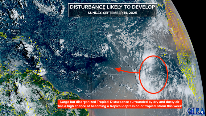
This satellite image shows the current state of the tropical disturbance in the Atlantic, providing valuable insights into its potential development and trajectory.
Assessing the Larger Tropical Outlook
Interestingly, long-range computer models show next to no tropical activity after this disturbance, with tropical activity suppressed around the entire Northern Hemisphere. While the reasons for this suppression are unclear, it is essential to take these developments one week at a time and continue monitoring the situation.
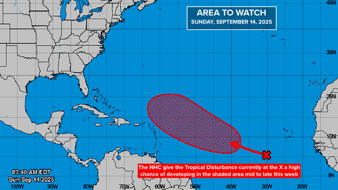
This graphic provides a detailed overview of the development chances of the disturbance in the Atlantic, highlighting the complexities and uncertainties involved in hurricane forecasting.
For the most up-to-date information on this tropical disturbance and other weather-related news, visit Here
Image Source: www.foxweather.com
