
Atmospheric Rivers Bring Heavy Rain and Snow to California
Atmospheric rivers continue to impact the West Coast, with a series of storms threatening high winds, heavy rain, and flooding in California. According to FOX Weather Meteorologist Jane Minar, the state is bracing for a significant weather event that will bring much-needed rain and snow to the region.
After an extremely active week in the Pacific Northwest, the weather pattern is shifting to focus on California, giving overwhelmed areas in the region a much-needed break. Rounds of rain, snow, and wind are set to slam California starting Sunday, elevating flash flooding concerns that will last through the rest of the week.
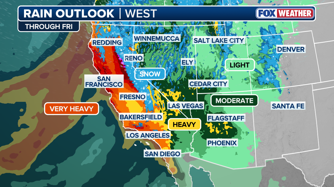 This graphic displays a rain outlook in the Southwest through Friday.
(FOX Weather)
Impact on Travel and Daily Life
Three rounds of precipitation are expected to bring travel headaches to the entire state of California, affecting major airports such as Los Angeles International Airport, San Francisco International Airport, and Sacramento International Airport. The storms will also impact vehicular travel on I-5, I-10, I-15, Highway 101, and I-40.
The activity begins Sunday as the next atmospheric river shifts south, positioning itself across Northern California. A strong area of low pressure moves into the Gulf of Alaska, while high pressure over Southern California acts to funnel moisture from Hawaii, making this a classic “Pineapple Express.”
 This graphic displays the rain forecast in the West on Sunday.
(FOX Weather)
Flash Flooding and Rainfall Totals
Some areas could see a month’s worth of rain, while others could see most of their yearly average in just a few short days. Widespread rain is likely across most of Northern California starting Sunday, with flash flooding expected from the Napa Valley north to Chico. A Level 3 of 4 (Moderate) flash flood threat exists for Northern California and the northern Sierra Nevada foothills.
Further south, a Level 2 of 4 (Slight) threat includes major cities like San Francisco and Sacramento. Flood watches have already been issued for most of Northern California through at least Friday. Widespread totals of 3 to 5 inches of rain are expected across Northern California, including coastal regions.
 This graphic displays the snow forecast in California on Sunday.
(FOX Weather)
Snowfall and Mountain Impacts
The snow-starved Sierra Nevada will finally see impactful snowfall, allowing ski resorts to thrive this season. Coastal impacts are also likely starting Tuesday into Wednesday, with wind gusts as high as 80 mph possible.
Round Two: A California Christmas Surprise?
From Tuesday night into Wednesday, a second round of flooding rain and powerful winds will move onshore in Northern California. This storm is expected to intensify as it moves inland, bringing wind gusts up to 80 mph to coastal areas and the potential for even more flooding.
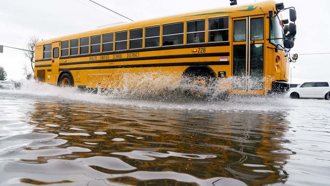
FILE: A school bus drives through floodwaters in Rialto, California, US, on Tuesday, Feb. 6, 2024.
(Kyle Grillot/Bloomberg / Getty Images)
Moisture will also shift south during this second round, with rain expected to move down the coast through Central and Southern California into Christmas Eve and Christmas Day. This will significantly impact holiday travel along the I-5 corridor, with current forecasts calling for 3–5 inches of rain in the Los Angeles metro area.
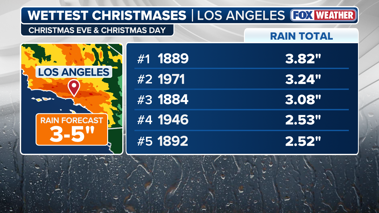 This graphic displays the wettest Christmas days in Los Angeles on record.
(FOX Weather)
For more information on the heavy rain and mountain snow targeting California this Christmas, visit Here
Image Source: www.foxweather.com
