
Winter Storm to Bring Snow Showers Across the East Coast and Great Lakes
The next round of winter weather is on the way for the U.S., impacting at least 25 states and potentially causing snow showers as far south as North Carolina and Tennessee. A surge of warm air will turn most of the precipitation into rain instead of snow, which will then pivot to the East Coast by Wednesday.
Originally, forecasters predicted that a large clipper system that is heading towards the Great Lakes region on Tuesday would fuel a complex winter storm and bring intense snowfall throughout the East. However, the latest forecast indicates that the system will bring rain instead of snow, with the cold front behind the system becoming the primary driver for the rain and snow.  People walking through heavy snow in Chicago on Saturday.
Lake-Effect Snow and Upslope Snow Expected
As the fast-moving clipper continues to head south, the cold front behind the system will become the primary driver for the rain and snow. While this new setup limits the potential of a powerful snowstorm, it is still expected that many areas will be impacted, including parts of the Ohio Valley that may see some snow showers. 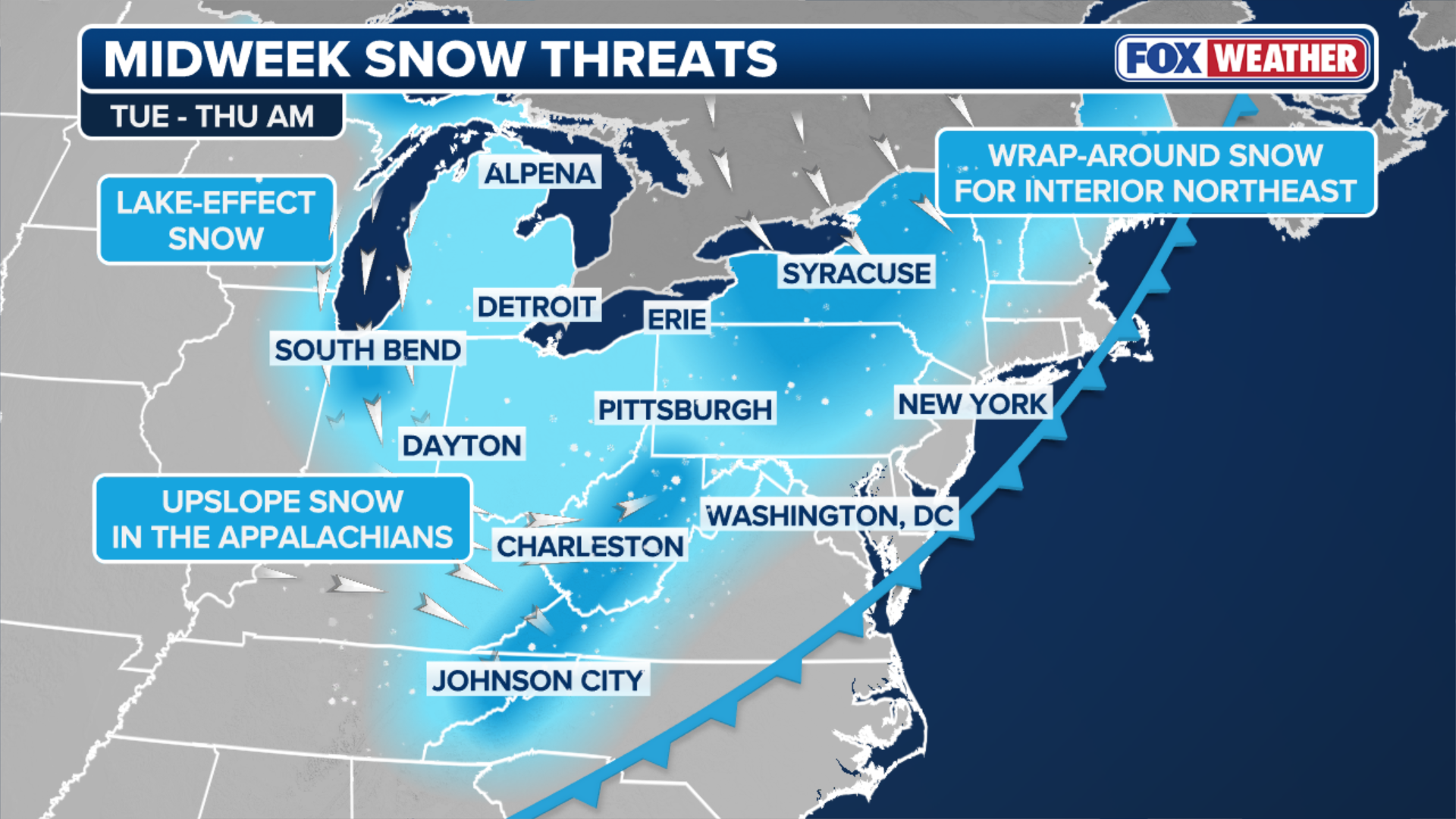 Areas expected to be impacted by the lake-effect snow. The Lake Michigan shoreline in Michigan westward toward the Indiana-Illinois border will be greatly impacted, especially if the wind changes from southerly to northerly.
The FOX Forecast Center said that snow will begin late Wednesday through Thursday, bringing moderate to heavy snowfall with totals between 8 and 12 inches. Lake Superior near Marquette, as well as Lake Erie, Lake Ontario, parts of northern Pennsylvania and Upstate New York will experience lake-effect and lake-enhanced snowfall as well.  Dangerous snow blankets Michigan during post-holiday winter storm
Uncertainty About Wind Direction
There is still some uncertainty about the wind direction, specifically whether the wind will shift from northerly or northwesterly. If wind orientation changes, it will alter which areas see the heaviest snowfall. The storm will start to make its way through the Appalachians starting late on Wednesday, mostly affecting the mountain region. 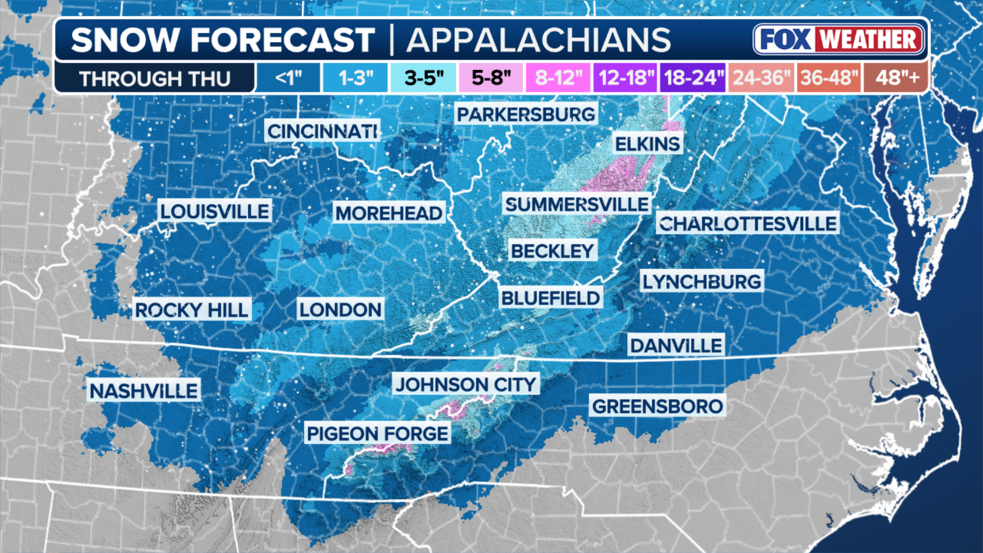 The amount of snow forecasted in the Appalachians. At this time, heavy, widespread snow is unlikely outside the highest elevations since temperatures there will be too warm.
Most of the accumulating snow will happen from early Wednesday and through Thursday morning. Then it will taper to flurries by Thursday afternoon. For more information on the winter storm, visit Here
Image Source: www.foxweather.com
